Tuesday, March 30, 2010

Week 10 Spring Break Lab


This lab was pretty easy. It worked out well.

Thanks Joe

Monday, March 22, 2010

Week 9 Lab


This lab was pretty easy. I am becoming much more comfortable using ArcMap

1. Which tool did you use? I used the intersect tool. It gave me the same results.

2. Which tool did you use here? I used the erase tool to take away the park areas from layers I unioned.

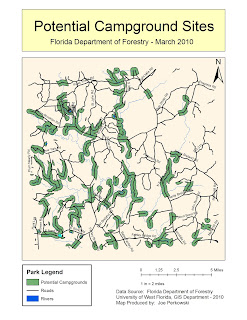
3. How many features are in this layer? I got 79 features. The largest was 7765053.672 square meters and the smallest was 748.346256 square meters.

Monday, March 1, 2010

Week 7 - Data Editing in ArcGIS


This is my Week 7 map...I didn't really run into any issues with this map. The digitizing was pretty straight forward in the ESRI website describing how to digitize and modify map features.

Saturday, February 20, 2010

Module 5 - GIS Data Search


I didn't have any problems finding the map data. Though I did run into hard disk space problems when I uploaded the data files to the server. The projection used is Transverse Mercator.


Sunday, February 7, 2010

Haiti Earthquake Magnitude Map


This map shows the earthquake intensity around different locations in Haiti. I found this map at the USGS website. It can help geologists determine the different locations where the highest intensity quakes occured. Relief worked could also use this map to determine where the most medical resources and food supplies should go to.

Week 4 - Projections


This map shows the area in square miles for Alachua, Escambia, Polk and Dade counties. The map uses graduated colors to distinguish the area in square miles